Angel Island State Park Camping
Camping in Angel Island State Park
Overview
Here’s a custom Google map I made with all the trip info.
Total trip length: ~26 hours
Campsite cost: $30
| Distance | Cost / Person | Route |
|---|---|---|
| 3 miles | $4 | Rockridge BART station via Lyft. |
| 10.7 miles | $6 | Rockridge station to Pier 41 via BART and F line. |
| 6 miles | $8.25 | Pier 41 to Angel Island via Blue&Gold Ferry. |
| 2 miles | – | Ayala Cove to Campsite #5. |
| 1 mile | – | Campsite #5 to summit of Mt. Livermore. |
Trip report
We just got back from an excellent camping trip to Angel Island State Park. Overall, the trip took just a little bit longer than 24 hours and involved traveling via car, trolley, BART train, ferry, and our feet. The views were incredible, the hikes were gentle, and the company was wonderful.
10:50am
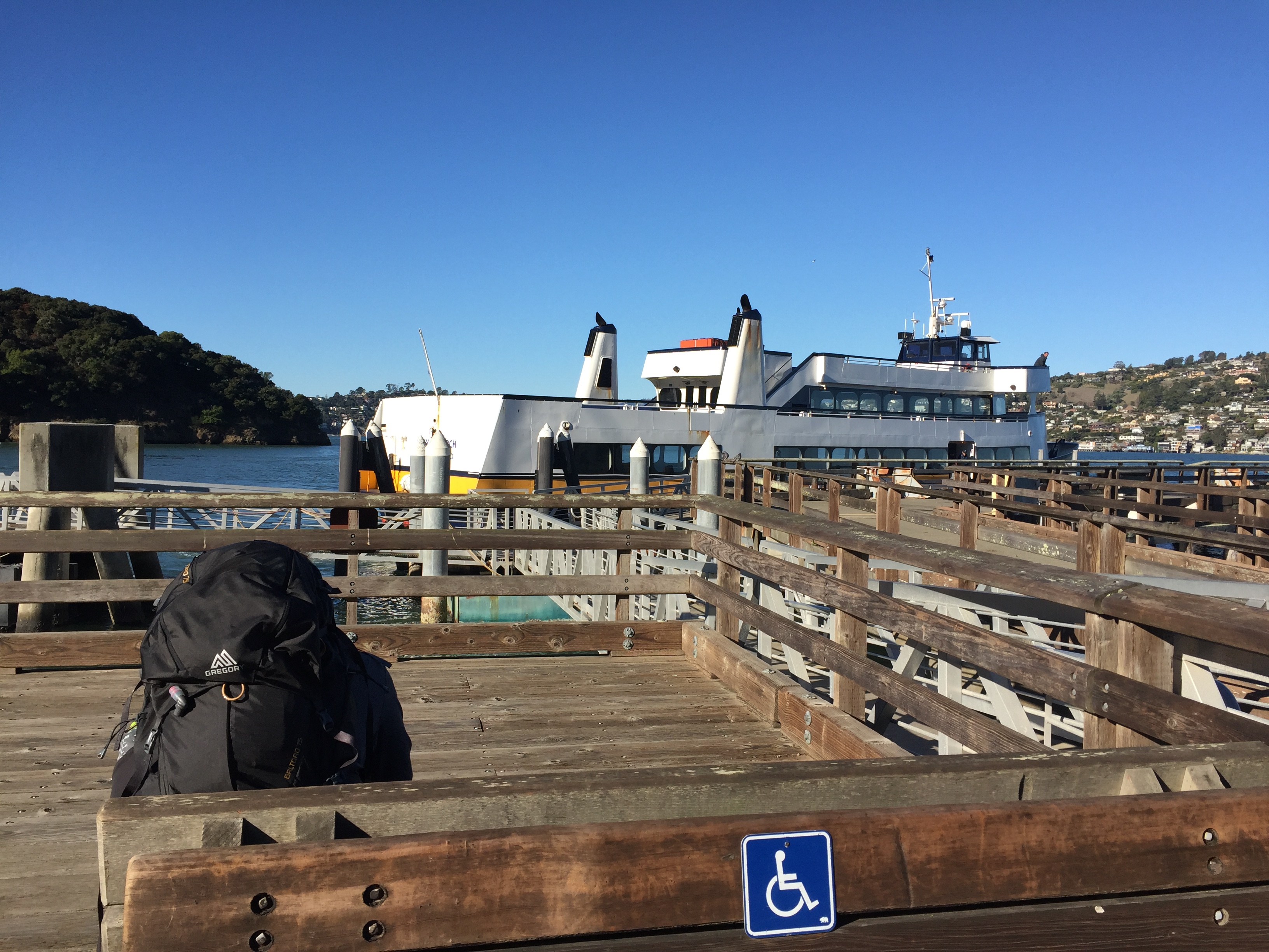
For us, the trip started with a Lyft to BART from our apartment, then a 30 minute ride to the Embarcadero stop. We stopped at the Ferry building for some snacks and to refill our Clipper cards, then caught the F-line along the Embarcadero until Pier 41. There, we got our tickets for the Angel Island ferry. We bought round-trip tickets (good for any trip day/time) and got a discount for being campers with a reservation! The website says to get in line 30 minutes early, but the lady who sold us our tickets told us to get in line at 1:00 for the 1:15 ferry.
1:15pm
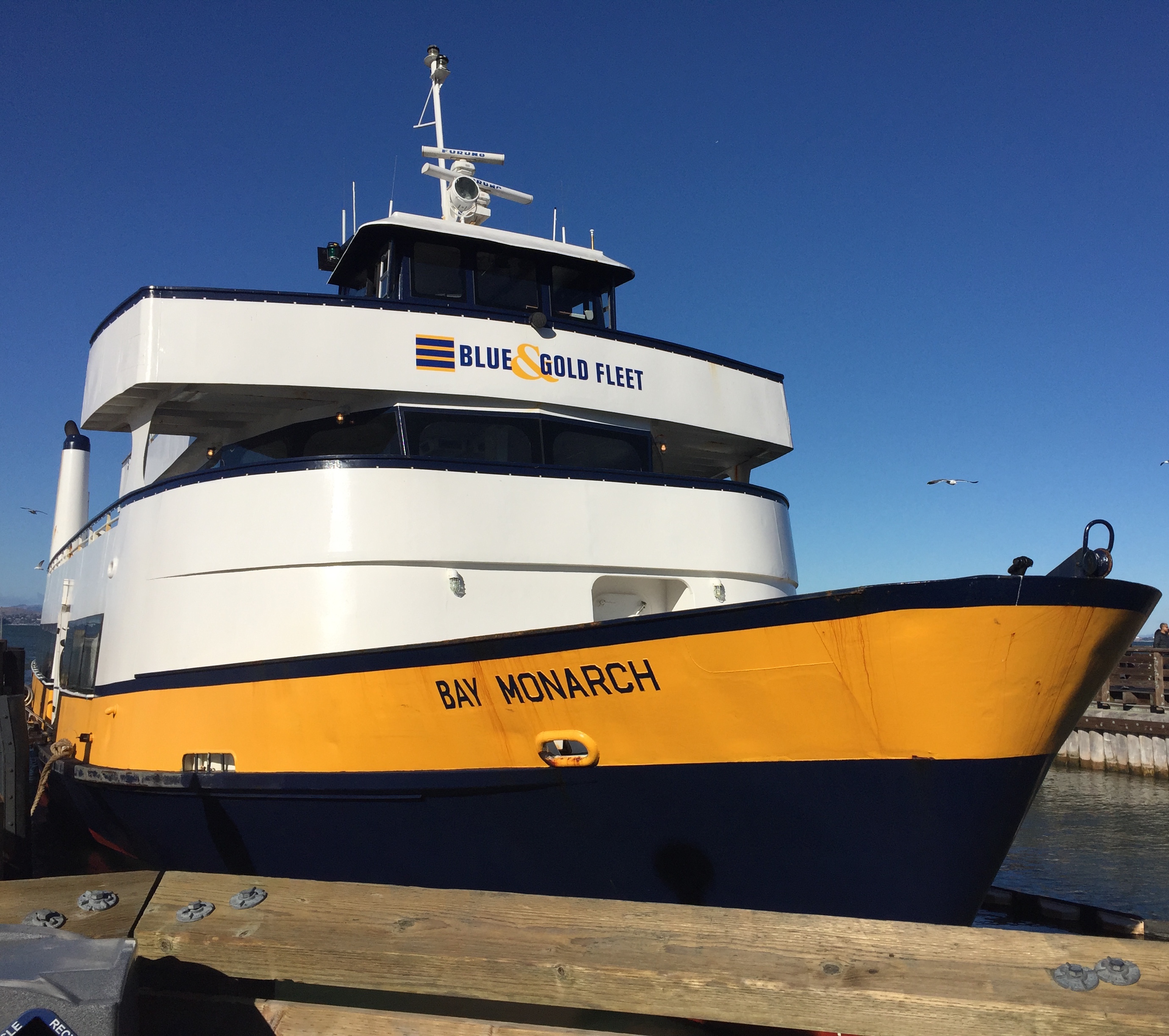
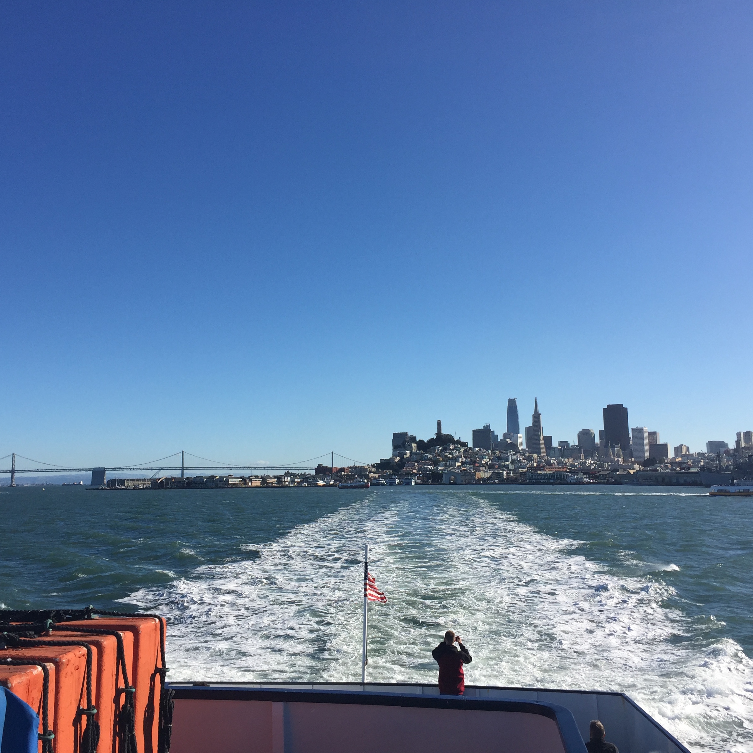
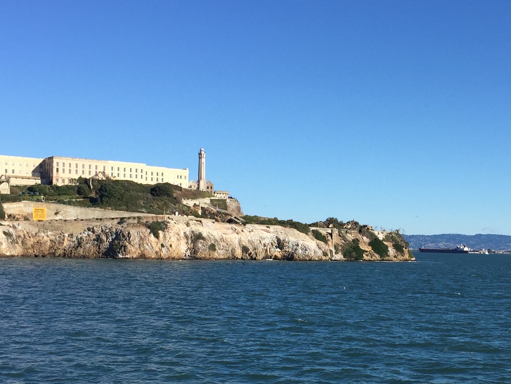
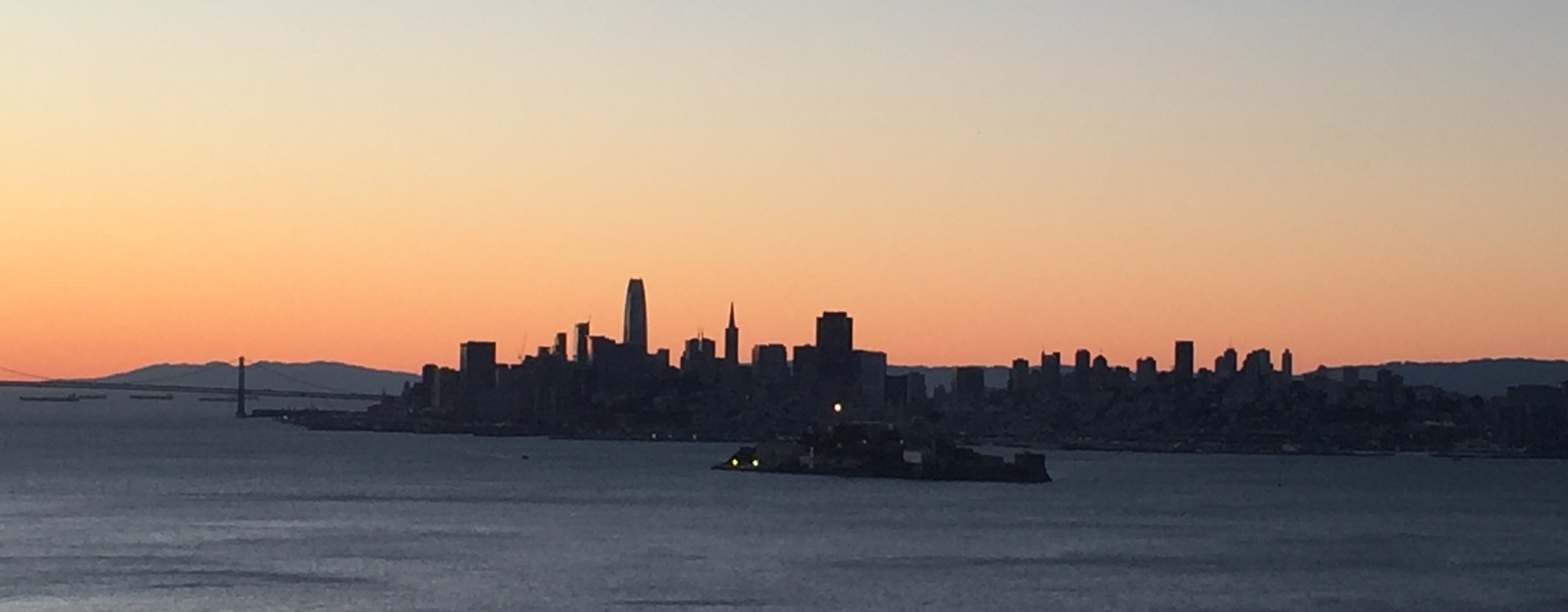
The last ferry to Angel Island left right on the dot at 1:15pm (so don’t be late). The trip to the island is a quick, gentle, 30-minute ride with gorgeous views of the San Francisco skyline, the Golden Gate Bridge, and Alcatraz Island.
1:40pm
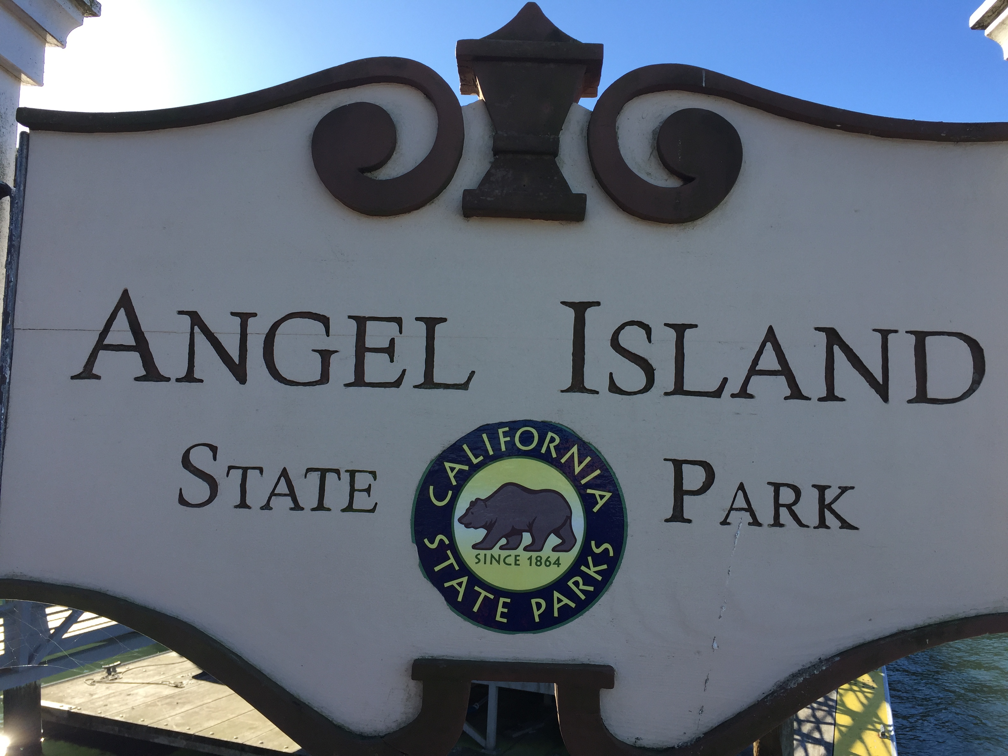
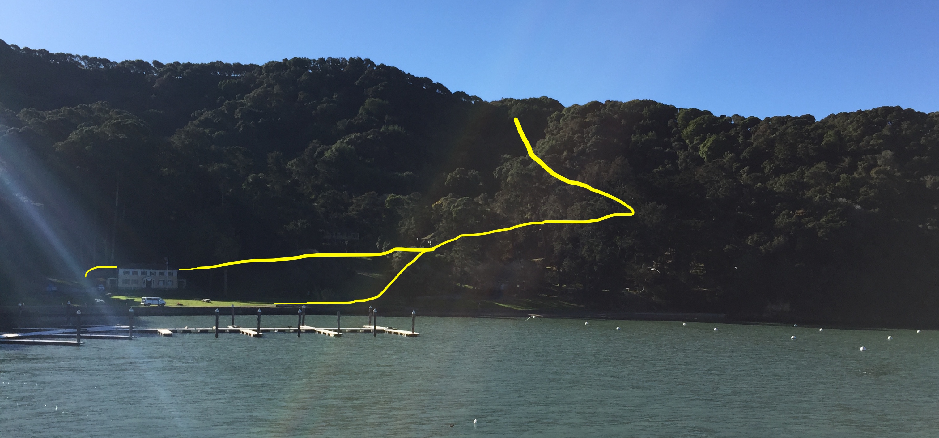
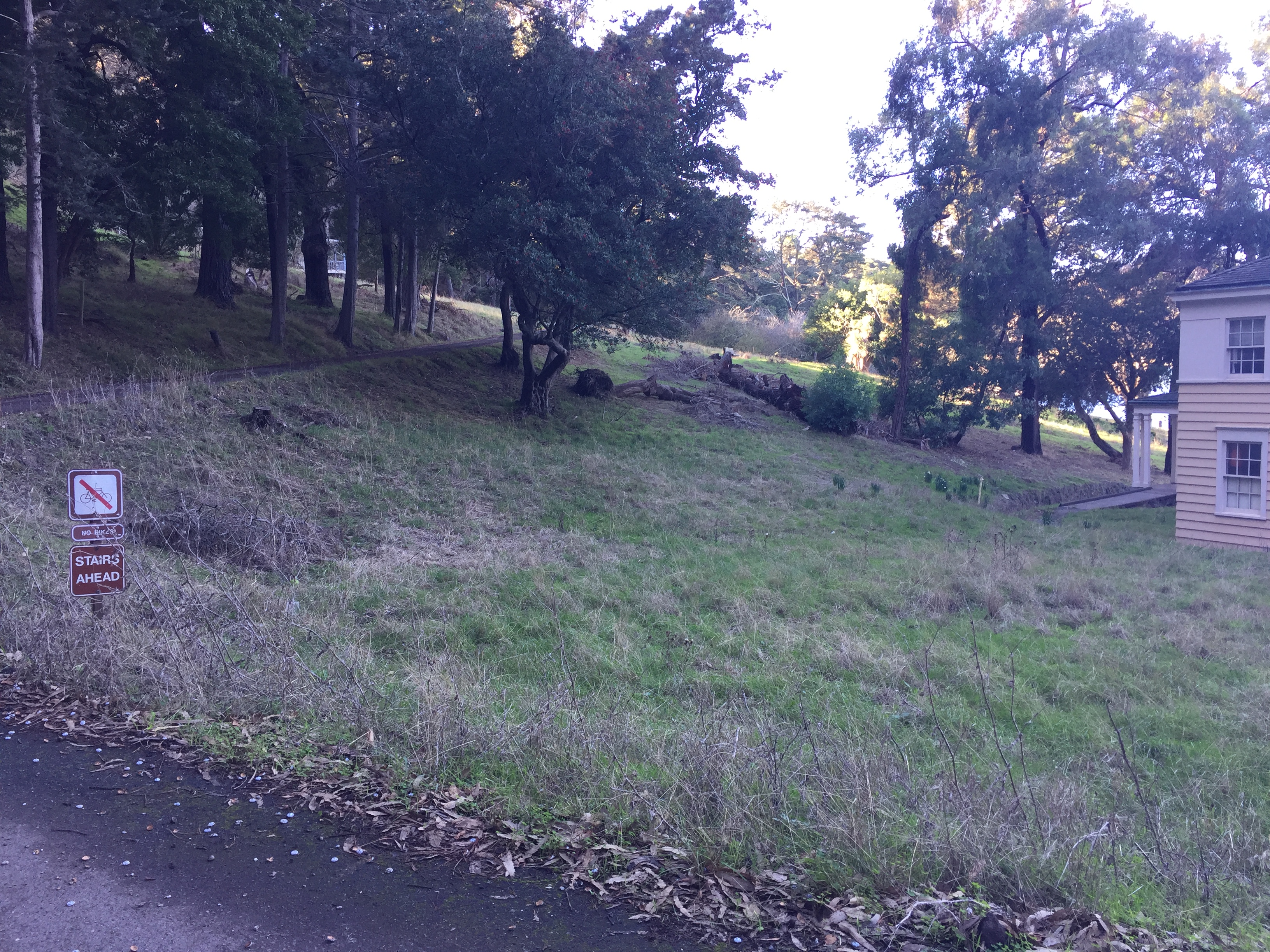
The ferry arrives into the beautiful Ayala Cove. We had a quick check-in with the park camp ranger, who went over the rules with us. There are no fires allowed on the island at all, only charcoal fires or campstoves. She also warned us about the very bold raccoons - apparently some people leave their tents open to let the raccoons crawl in and out at leisure. She also told us about the shortcut up to the main perimeter road, drawn below in yellow. The easiest way is just to talk through the front lawn of the house. The stairs look like they go straigh to the houses above, but there’s a little path up there you’ll take off to the right around the ridge. You can also walk behind the house and you’ll see stairs to the left (don’t take those), or an asphalt path going off to the right. Take the asphalt path to the right (second image below), walking past the sign that says “stairs ahead”. As you can see in the image below, both routes get you up to the perimeter road in the end (end of yellow line at top of ridge).
From there, it’s a perfectly flat paved road around the island. We were staying at the “Ridge” campsites, about 2 miles from the cove.
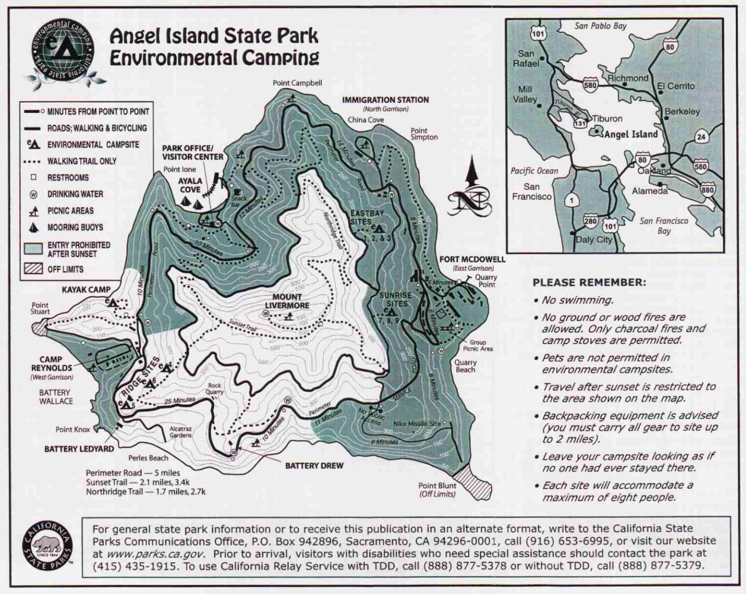
Sidenote, there are several maps floating around. Based on what we saw, this one is the most accurate in terms of hiking trails. However, this one is the one they give you when you arrive,, and they’re both good. To be specific, you’ll see that the map I prefer has a trail from the Ridge sites up to the fire trail, and the other maps are missing that. The ranger told us that route “isn’t maintained” and “might have poison oak” but we didn’t see any, and it was a very clear trail!
The “Ridge” campsites have a reputation for being very windy. Either we got lucky, or there’s just not as much wind this time of year, but it was very calm on the “Ridge” side of the island. We had reserved site #5, which has an incredible view:
As well as several great spots for tents and trees for wind protection if needed:
Site #6 had good tree coverage as well, and is the closest to the bathroom (the bathroom is basically in the site):
Site #4 is hands-down the best view of any campsite I’ve ever seen. Really amazing. Panoramic views, no trees to block any views, great stump to sit on and watch the sun rise….fantastic. Definitely the most isolated, but also the most exposed to the wind:
3pm
We headed up to the peak for sunset and a picnic dinner. It’s mostly flat, punctuated by a few steepish bits, but overall a very easy hike with incredible views as you head up:
There are lots of benches to stop and watch the sunset, but the top has the best view (and a friendly turkey vulture):
Hard to overstate how gorgeous it was up here. We walked back down as the sun set, along “Sunset trail”:
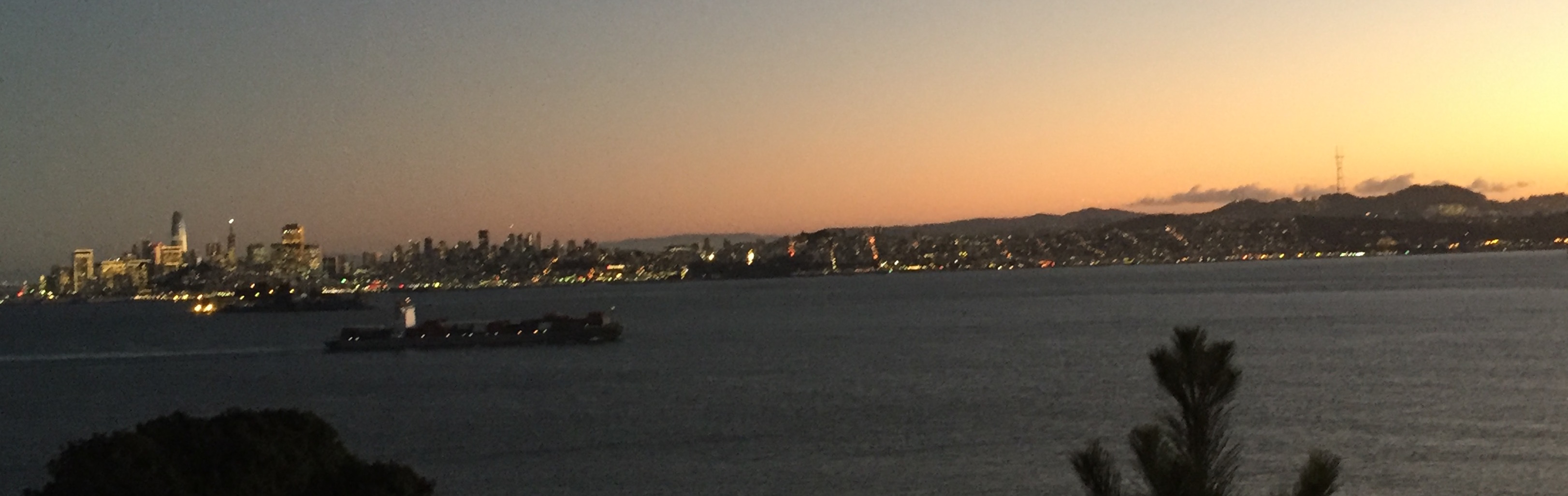
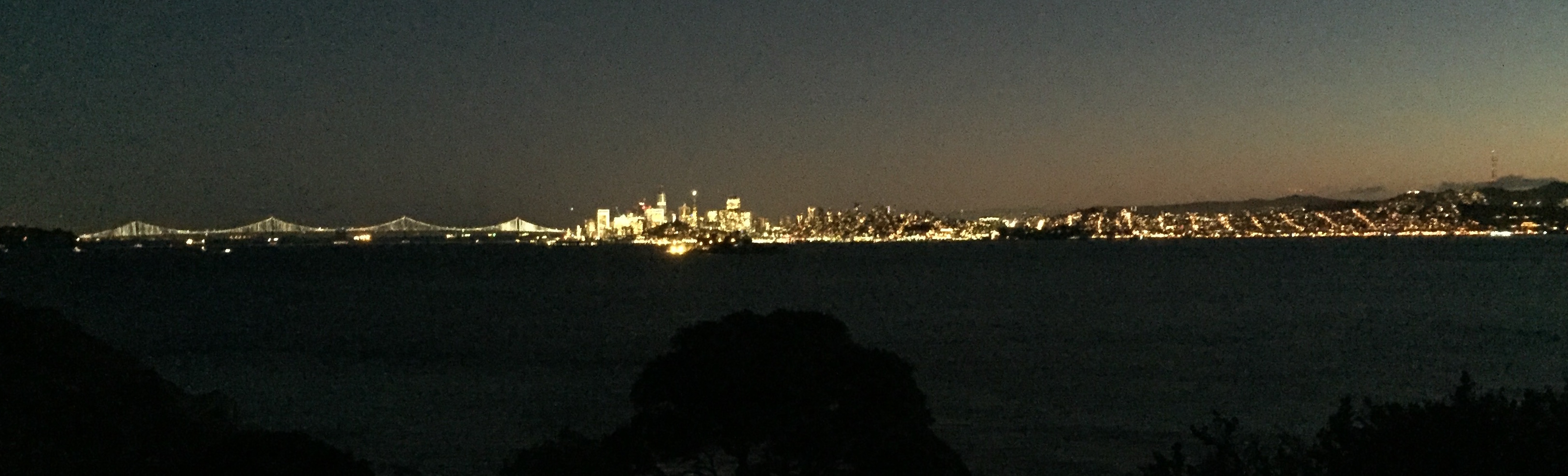
Even the night views of San Francisco were amazing! These were taken from the picnic table at campsite #5.
8:30am
The next morning, we ate some breakfast and walked down to the beach. The trailhead to get to the beach is a few feet to the West on the main perimeter road when you walk down the hill from the Ridge sites. The entrance is right next to the fence:
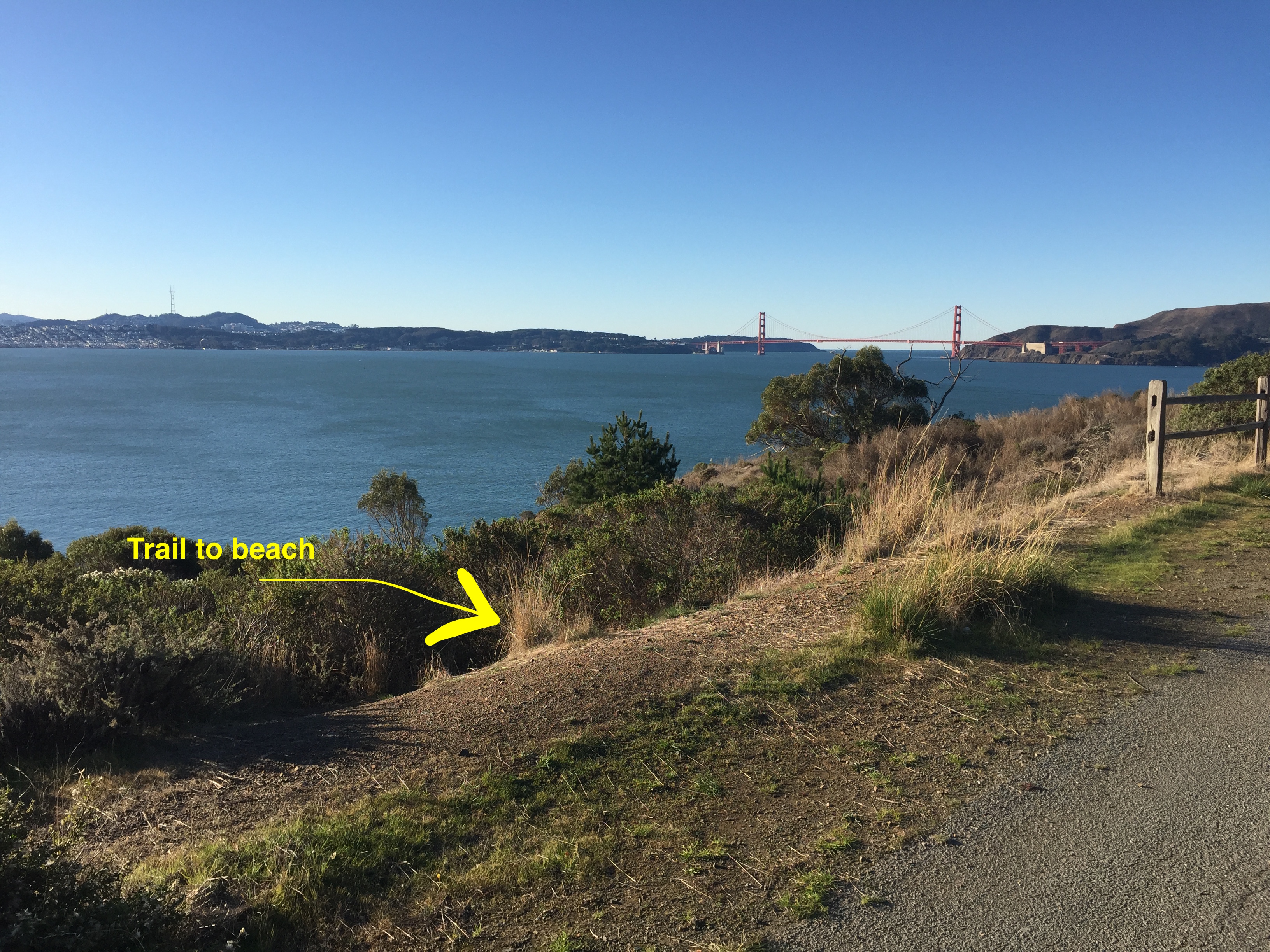
The beach is small, but lovely. If it’s ever warm enough to swim, this would be an AMAZING spot to get in the water.
9:40am
After that, we packed up and walked the two miles back to the cove to catch the first ferry home at 10:20am.